Showing posts with label map. Show all posts

Wednesday, August 19, 2020

Why are there differences in my land grid?

There are many reasons for the differences between land grids. Some land grids do not come with everything included, while others have limited attributes. Furthermore, others have serious accuracy issues. Understanding these differences helps managing your assets within your AOI’s much easier. Section Township Range doesn’t really mean Section Township Range.

The truth is that most vendors do not provide the full land grid picture as part of their basic package. Layers like lots, quarters, and quarter quarters are considered premium offerings. Without these layers it makes mapping your assets much harder, especially when those assets refer to footage calls and legal descriptions.
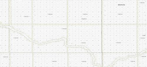

The full land picture analogy also applies to attributes. Without detailed and unique attributes, such as Section ID, Legal Description, it can be hard to auto map your assets. The same applies to the data model used by the vendor. Without an organized and consistent data model it can be hard to auto map your assets.

In the PLSS states (OK, CO, etc.) most, if not all, vendors use the same source, the USGS 1:24k topo maps. This makes it easy to compare accuracy and completeness when looking at land grid in these states. The only caveat is that the source (USGS 1:24k topo) is king, not necessarily the changes on the ground. An example would be as rivers move; the source may not have changed.

Now, Texas is a completely different kettle of fish. Most vendors use the Railroad Commission as the trusted source, especially for contested areas. However, the Tobin land grid does seem to match subsurface leases more closely, imagery more closely, and negates overlaps for a cleaner looking land grid. The reality is that Texas is a moving piece of art with many pieces to the puzzle. There are two sources. One is based off the days of metes and bounds from landmarks that can be very obscure. The other is footage calls from landmarks and survey markers. This results in real contested areas and overlaps.


Land grid can, and should be, a complex beast. That being said, understanding your sources and being able to check those sources is vital in winning that battle. Things like knowing that section township range grid also means lots, quarters and quarter quarters, will complete that picture. While having a solid and complete data model within the land grid will help you master your assets in your AOI’s much more easily. Land grid is a beast, but it can do magical things for you and your organization if it can give you that complete picture.

Saturday, October 20, 2012

Our GIS Catalog is stacked!


US Land Grid, Inc. (http://www.uslandgrid.com) has just made available for instant download our 2,700 GIS data product. Ready for instant download is the Texas and PLSS Land Grid, over 300 Tax Parcels, and countless counties of PDF maps. No more waiting for your different datasets, get one of the 2,700 GIS datasets or PDF maps that you need instantly and without any hassle.
Our land grid (http://www.uslandgrid.com/land.html) data has been ready for a few months now. Apart from offering multple datums at no charge, our data comes with the lots, the quarters and the surveys. We don’t separate layers that belong to the land grid, we give you everything. Without a doubt a largest live, ready to download, GIS dataset with over 1,100 products, our land grid data and texas survey data is the largest online GIS catalog for instant download.
Matching the vastness of land with tax parcels (sometimes referred to as surface parcels, parcels, or surface ownership) completes the picture between land allotment and land ownership. Tax parcels (http://www.uslandgrid.com/parcels.html) become the meat in the sandwich between the land grid and surface leases. With over 300 counties of tax parcels ready for download online, our tax parcel dataset is largely focused on oil and gas plays – and from that perspective is very complete.
A new introduction, US Land Grid PDF Maps (http://www.uslandgrid.com/pdfmaps.html) provide 42 inch x 42+ inch maps that are beautifully designed and perfect for printing on plotters. Large scale and high detail, these maps are perfect for those of us that don’t have or use mapping software, or if we just want to print a quick map that can be marked up for presentation purposes. Oklahoma PDF Land Grid Maps are now complete. Texas is under construction. Watch this space, as we complete other states.
Our oil and gas data data is taking some time. We are working towards proving another excellent dataset that is tied to an industry leading data model and povides the consistency and accuracy in data you expect from US Land Grid. We hope to have our oil and gas GIS data release in early 2013.
In total, this means we now have over 2,700 products ready for instant download now available at US Land Grid. This is a huge number! As we continue to grow we expect this number to reach 5,000+ product ready for immediately delivery to your mapping program or PDF viewer. As we grow are datasets and offerings, we will also be growing our formats and delivery methods. If there is a GIS dataset that you would like to see, please let us know and we will do our best to make it work for you and US Land Grid.
From a GIS and mapping perspective, we hope you enjoy the intant delivery and service that we provide at US Land Grid – your new online source for Oil and Gas Data! We never close, and we never disappoint! Our industry leading guarantee makes any customer happy every single time. Please stop by and say hello.

Sunday, October 14, 2012

PDF Land Maps


US Land Grid (www.uslandgrid.com) has released it's first set of PDF maps ready for instant download. The PDF land grid maps are high resoultion, with a set print resolution of 42 x 50+ inches. The current states include Texas, Oklahoma and Colorado - with display layers including section, township, quarters, abstract, block, survey, sub survey and lots. For more information - please go here -www.uslandgrid.com/pdfmaps.html.
The maps have been hand made and are ready to use - virtually printable in any format and size - but with a set resolution of 42 x 50+ inchs for ultimate results with plotters. By enabling 42 inch printing the PDF land grid maps produce high quality, great looking wall maps that can be marked up in accurate detail.
In the PLSS states these large PDF maps produce high detail section township range maps that include lots and surveys. Adding the nice looking cartography by layering the land grid are the major roads, cities and water areas.
In Texas, the PDF maps include high details representations of abstracts, blocks, surveys, sections and sub surveys. Once again, the major roads, cities and water areas layer the land grid.
The appearance of the maps make for perfect basemaps that can printed in large scale and used for presetation and analysis. The land grid on the maps is smooth but not overbearing. All labels and references are appropriately marked.
Please see example here - www.uslandgrid.com/pdfmaps/tx-map-1.html
 PDF Maps
PDF Maps
These ready to use maps are a great addition to anyone interested in using and studying land data in their area of interest. With no mapping sogtware required it makes it easy to everyone to have a clean looking and ready to print map for any situation or presentation.
Texas, Oklahoma and Colorado is now being posted to our catalog of instantly downloadable products. As per our other products, land grid - tax parcels - oil and gas wells - PDF maps, you get your downloads instantly when you use US Land Grid.
Thanks again to everyone's support - we will keep you tuned to our next gis data release.
Contact: US Land Grid, Inc.
http://www.uslandgrid.com/
Phone: (877) 870 8872
http://www.uslandgrid.com/contacts